occupy ronda
a resilient transformation of public infrastructure
In recent history, Barcelona has transformed from a coastal city into an international metropolis. The implementation of Ildefons Cerdà’s Exiample plan has extended the city to its geographical limits. Recent events such as the 1992 Olympics have brought in a new wave of tourism and excitement for the city. With nowhere else to expand, the city is now grappling with density while advocating for a greener and more sustainable environment.
Occupy Ronda Litoral transforms the existing ring road infrastructure in Barcelona to form a new green ring around the city—creating a vibrant public corridor connecting the sea, the city, the rivers, and the mountain: Barcelona’s four main geological features. In anticipation of the Olympics, the ring road construction sought to link together the four main Olympic areas; however, the highway subsequently divided Barcelona’s urban and environmental fabrics, separating the city from the sea and the mountains.
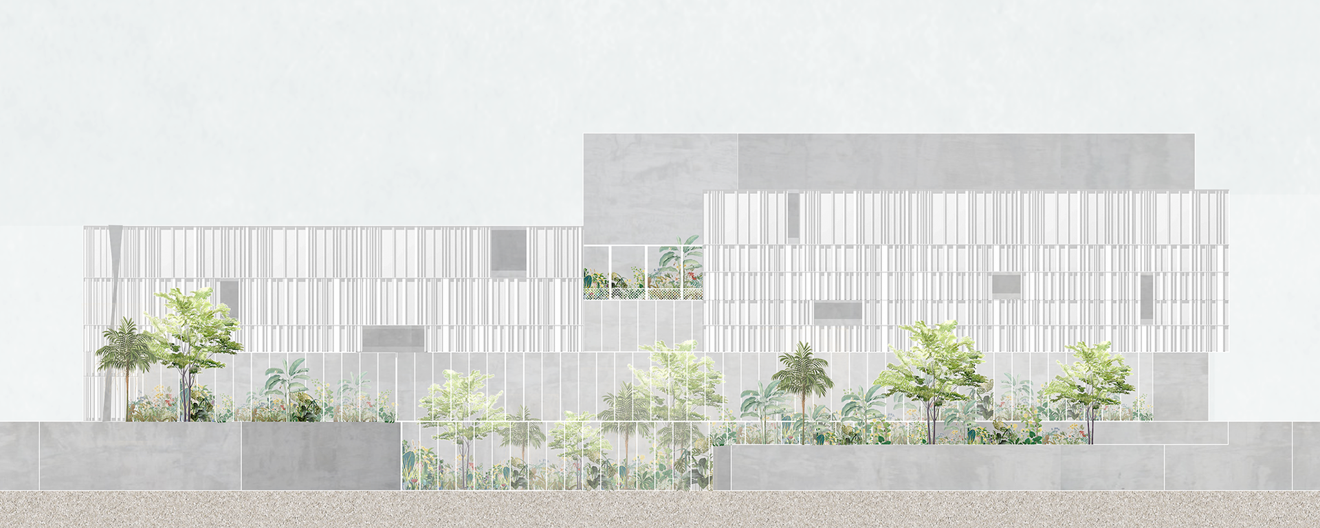
This project seeks to reverse these adverse consequences by converting the private-car-dominated public infrastructure into a resource for people that promotes biodiversity, natural water retention, and alternative forms of transit. The project manipulates and distorts the formal-material language of the Ronda Litoral walls to maintain the memory of the old infrastructure while facilitating new functions for the green corridor.
Location: Barcelona, Spain | Year: 2019 | Type: collaborative academic project | Institute: UVA at ETSAB | Advisor: Manuel Bailo | Team: Seshi Konu and Kristina Fisher
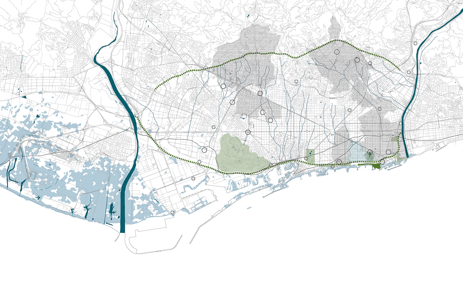
urban strategy
Barcelona’s existing ring road infrastructure is transformed into a new green ring around the city—creating a vibrant public corridor connecting the sea, the city, the rivers, and the mountain. While offering the potential for additional development, this new green system also aids in the city’s water management. With the increased magnitude of flash flooding events and sea-level rise, the corridor will work as a natural sponge collecting water from the mountain and surges from the sea.
site strategy
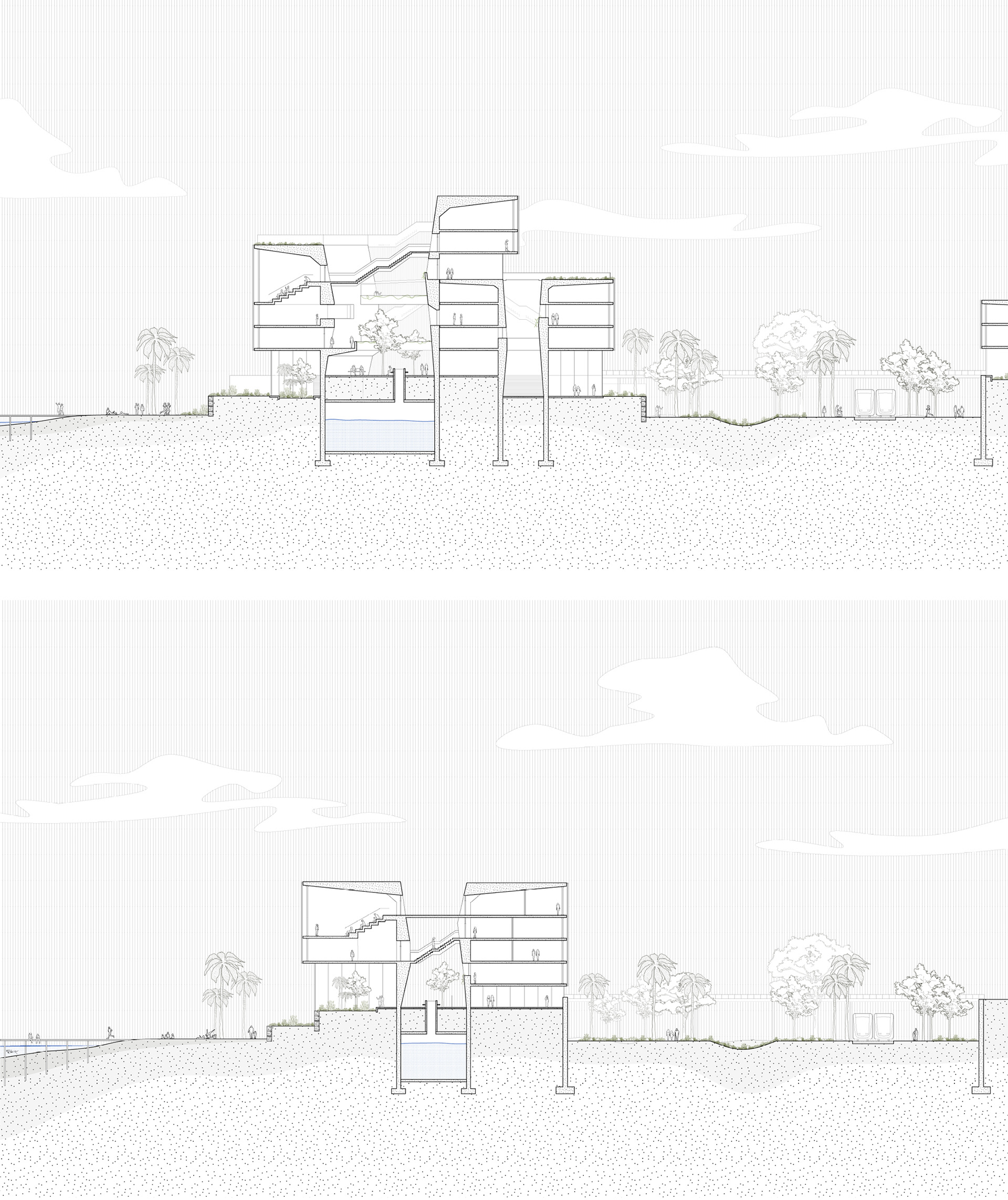
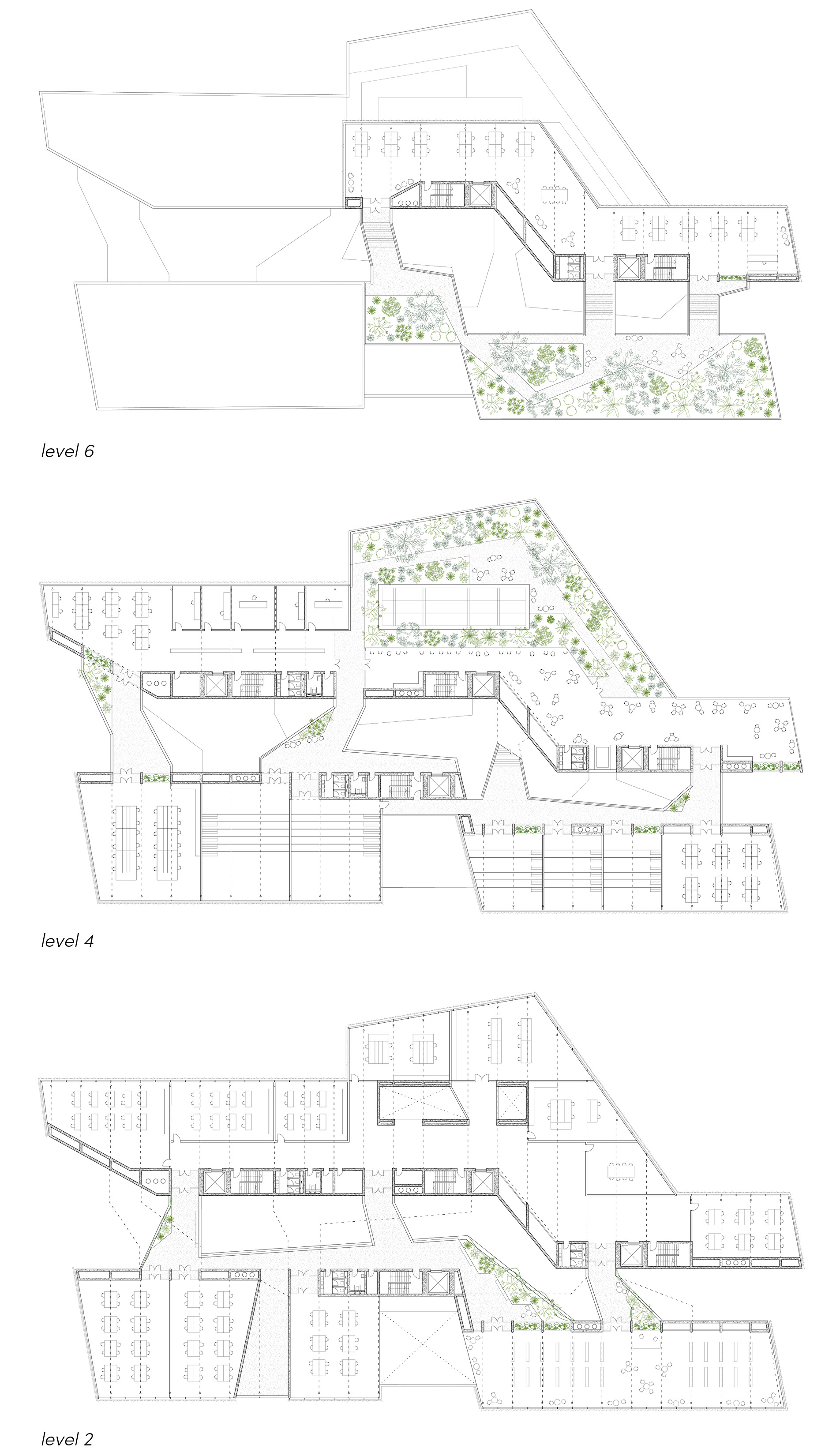
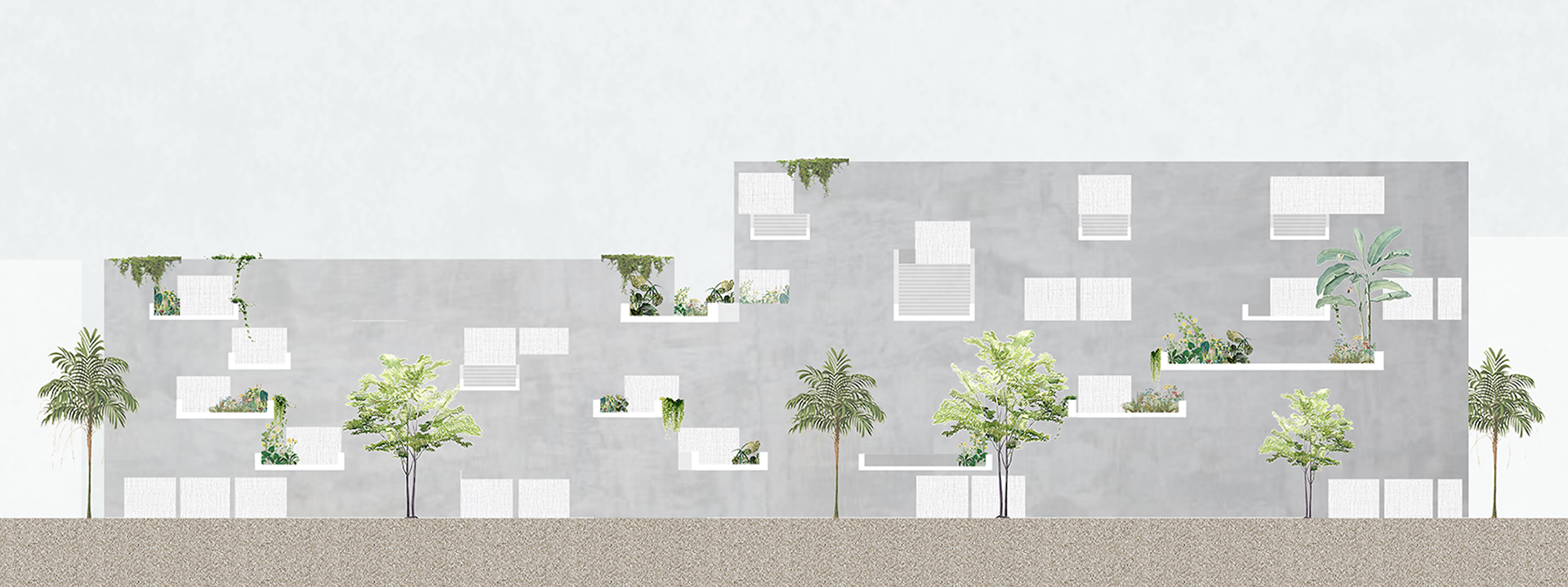
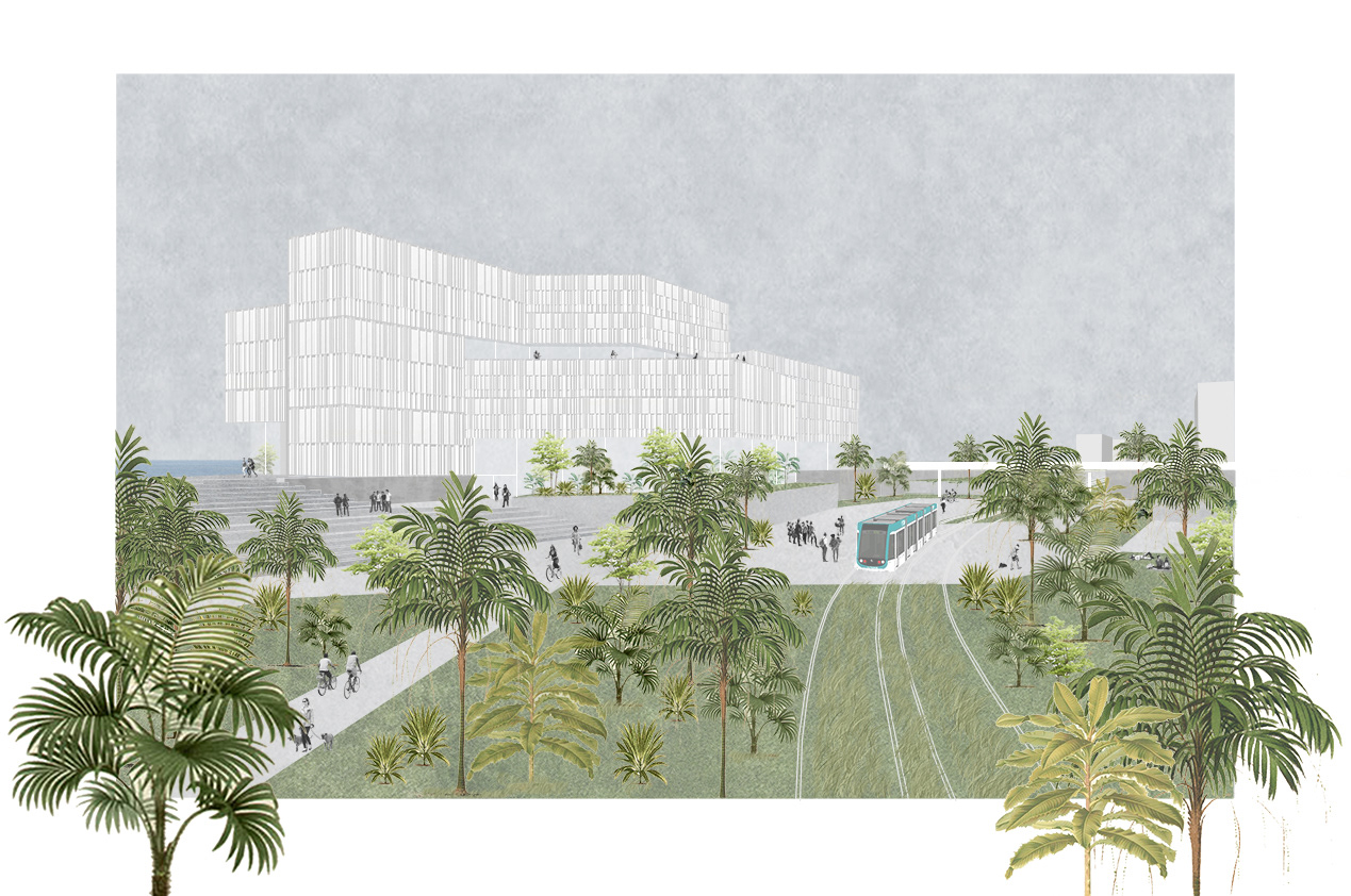
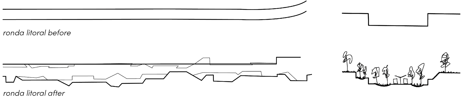
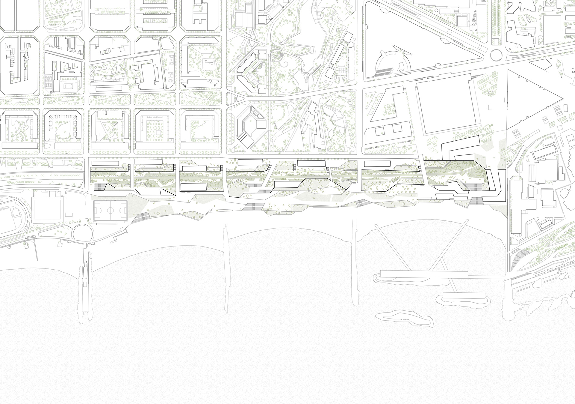
This design transforms and breaks apart the concrete walls of the sunken highway into a vibrant public corridor. The wall along the city side is cut strategically in small areas to guide water from the city into the corridor. The wall towards the sea deals with the unstable reality of sea-level rise by breaking down into large garden terraces that become a more resilient edge to the water. The master plan for the project consists of three parts: a new park/tram-line inside the Ronda, housing units dispersed along the old highway walls, and a public research institute at the end of the promenade.
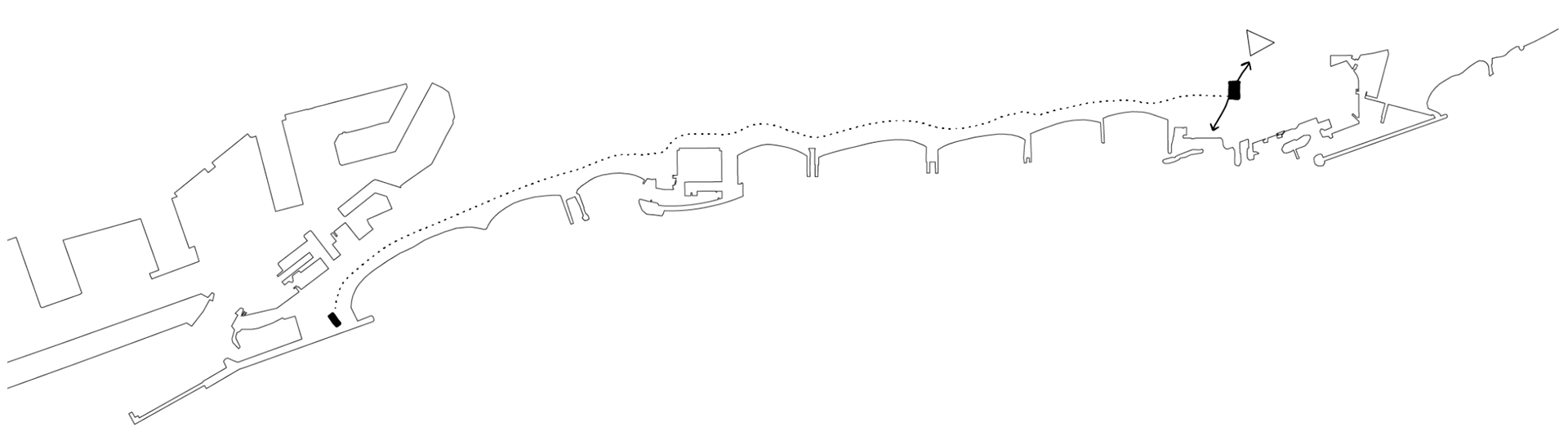
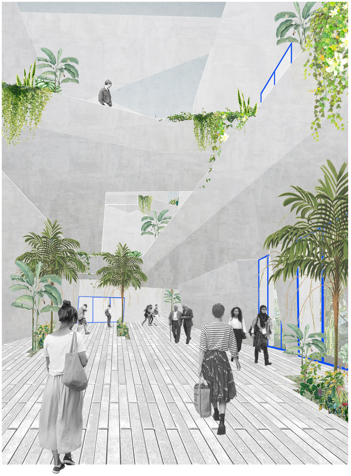
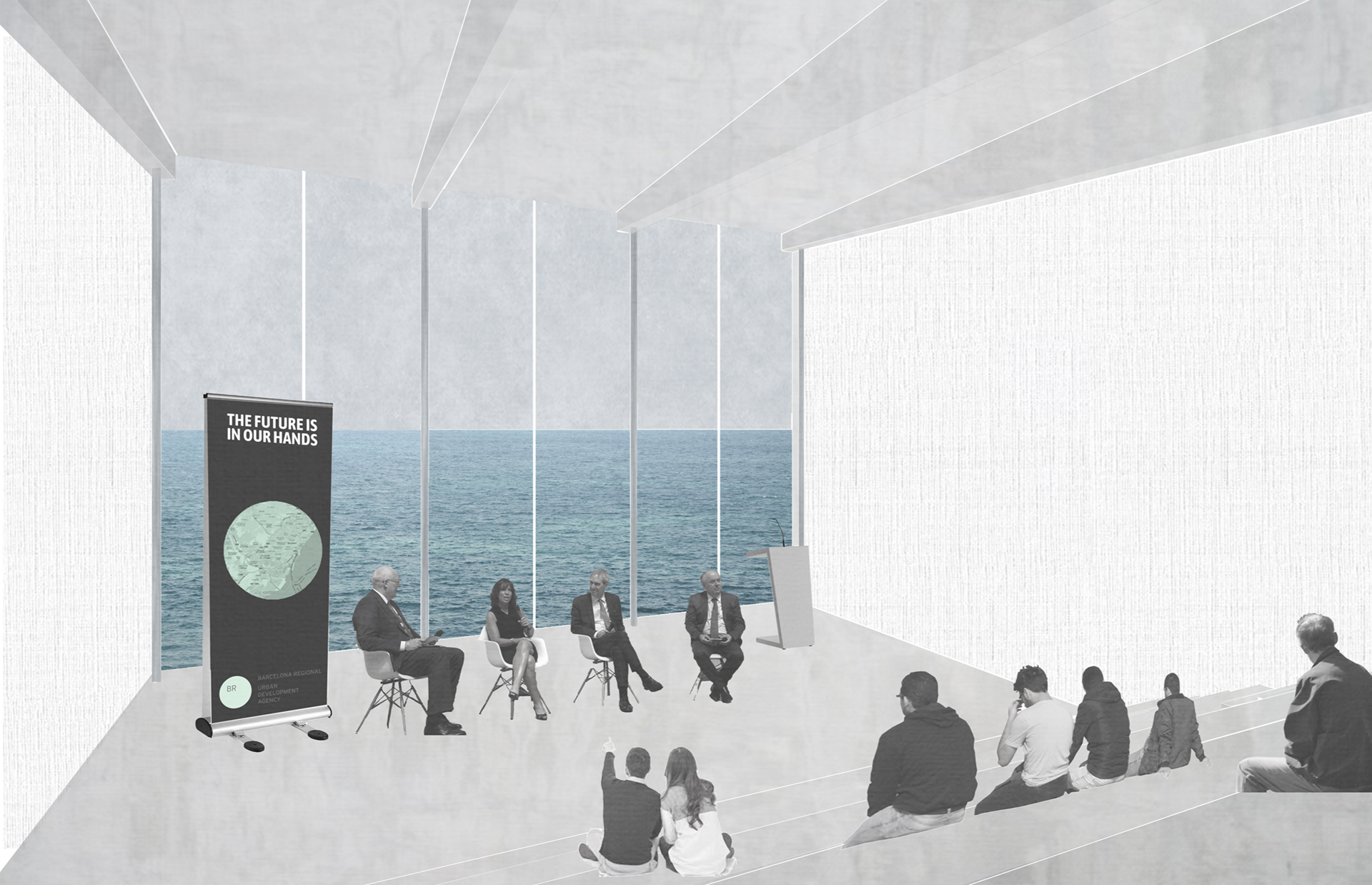
anchoring the promenade
Along the new green corridor, a public institute juxtaposes the large hotel at the start of the promenade and anchors the end of the beach promenade. This new anchor serves as a marine research institute and a new headquarters for the Barcelona Regional. This program creates a new public amenity that aims to connect local citizens and international visitors to current research efforts conducted by Barcelona today. Extending from the walls of the Ronda Litoral, this building suspends from a structural concrete corridor that serves as the primary circulation while simultaneously collecting rainwater.